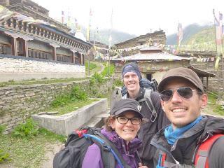
Hasta Braka se puede llegar siguiendo la carretera que enlaza Dhikur Pokhari con Lower Pisang, Humde, Braka y acaba en Manang o se puede ir por lo que se conoce como la High Route. Ambas opciones tienen, evidentemente, sus pros y sus contras. La ruta que sigue la carretera es relativamente llana y corta. La High Route te lleva lo suficientemente alto como para que el día sea verdaderamente útil para la aclimatación a la altura (básicamente te pasas el día a más de 3500 m de altitud).
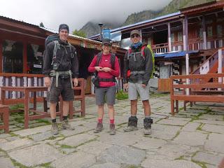
Nosotros escogimos ir por la High Route porque es por donde va el sendero para caminantes, porque queríamos hacer una buena aclimatación y porque pensamos que, al ir más altos, las vistas serían mejores.
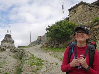

Este fue el primer día en el que necesitamos ponernos la chaqueta por la mañana porque hacía algo de fresquito. Duró poco ya que tan pronto como salió el sol pareció que alguien hubiese encendido un horno. No tuvimos un día con más calor o con el sol más abrasador en todo el circuito.
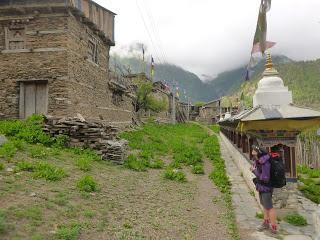
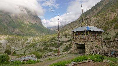
Empezamos la jornada con un paseo de unos veinte minutos por las llanuras al norte de Dhikur Pokhari, hasta que tocó empezar la ascensión a Upper Pisang, que no está mucho más arriba pero el camino está muy empinado.
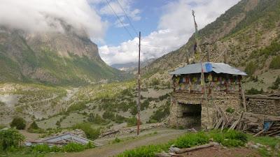
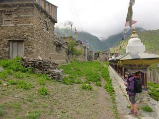
Upper Pisang resultó ser un pueblecito que bien podría estar en la provincia de Salamanca. Casas de piedra y señoras sentadas en la calle mirando a la gente (no mucha creo yo) como si con un simple vistazo pudiesen descifrar todo tu genoma.
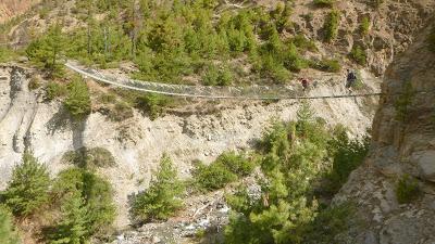
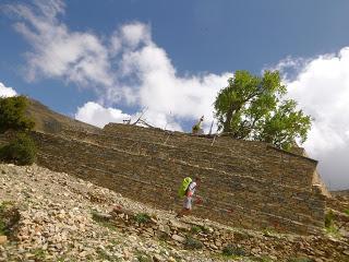
El siguiente pueblo de la ruta alta es Ghyaru, situado a 3670 m de altitud. Es, si cabe, todavía más pintoresco que Upper Pisang. O como dirían los mochileros de postín, “más auténtico”.
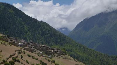
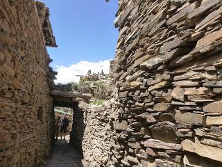
El pueblo se encuentra camuflado en la ladera de la montaña, las casas son de piedra y la mayoría de ellas están o a medio construir o medio derruidas, lo mismo da.
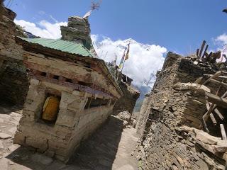
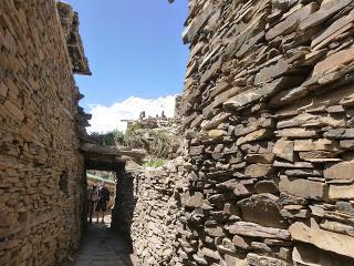
Las callejuelas son estrechas y algunas tienen lo que parece un amago de pavimentación con adoquines. No vimos ninguna teahouse por lo que suponemos que este pueblo ha seguido una evolución ciertamente menos turística que el resto de asentamientos que hay en el circuito.
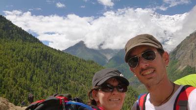
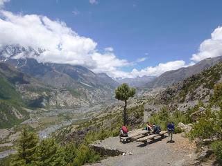
Fue de camino a Ghyaru cuando vimos por primera vez las cumbres nevadas del macizo de los Annapurnas, en concreto pudimos ver las cimas del Annapurna II (7937 m) y del Annapurna IV (7525 m) y ciertamente impresionan.
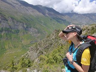
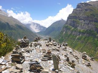
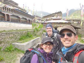
A las afueras de Ghyaru conocimos a Ina, una chica ruso-israelí que sólo vimos aquel día, y a Cristian, un ingeniero industrial chileno que había ido a Kathmandu a presentar su tesina en un congreso internacional y que acabó siendo el cuarto miembro de nuestra expedición.
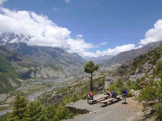
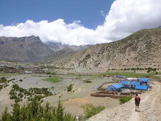
Desde Ghyaru el camino desciende la friolera de casi 10 metros hasta el poblado de Nawal (3660 m) donde por la presencia de guesthouses intuimos que los excursionistas suelen parar a pasar la noche en temporada alta. Por lo demás era un pueblo bastante soso.
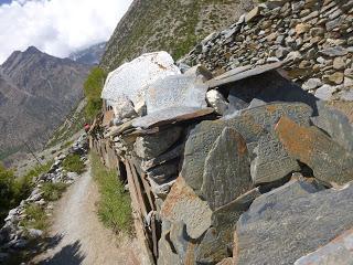
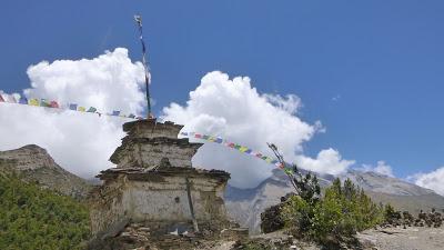
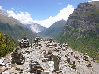
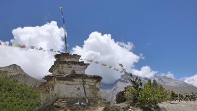
A la salida de Nawal nos esperaba una bajada infernal (muy divertida en bicicleta) que serpenteaba por una ladera arenosa que resulto ser el jardín o circuito de oraciones de un templo situado en la cima.
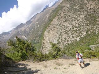
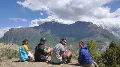
Una vez llegamos abajo pudimos escoger la ruta baja y directa a Braka o un sendero incierto que iba “por arriba”. Por algún motivo que aún hoy desconocemos elegimos la ruta alta, que nos llevó hasta 3800 m de altitud y que fue lo último que necesitaban nuestras piernas para odiarnos, si cabe, un poquito más.
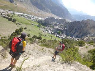
Cuando ya estábamos todos con el piloto automático pensando en si la guesthouse del día tendría ducha de agua caliente o no vimos Montserrat, o como aquí la llaman, Braka.
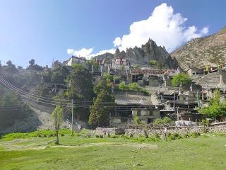
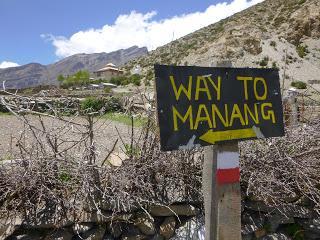
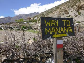
Braka es un pueblo situado en la ladera de una pared rocosa que se eleva vertical hacia el cielo y que se asemeja a un serrucho. Es famoso por su Gompa (templo) y por estar a media hora caminando de Manang, la capital del distrito y lugar donde acaba la carretera. Por el tema de la aclimatación a la altitud recomiendan hacer un día de descanso en Manang pero nosotros decidimos quedarnos en Braka porque la diferencia de altura es de apenas 100 m y desde Braka se pueden hacer dos excursiones perfectas para aclimatarse a esto de estar tan altos. Por este motivo el día “de descanso” se convirtió, en nuestro caso, en día de excursión.
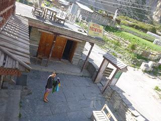
Nos alojamos en el Hotel New Yak donde cenamos unos energéticos espaguetis con tomate y setas que nos sentaron de maravilla. Necesitábamos un extra de energía par el día siguiente ya que íbamos a ascender hasta el Ice Lake, a 5000 m de altitud.RESUMEN DE LA ETAPA:Fecha: 6 de junio de 2016Hora y altitud de partida: 07:20 a 3060 mHora y altitud de llegada: 16:00 a 3439 mDistancia: 15 kmTipo de vía: Camino de cabrasClimatología: Tropical cambiando a alta montaña Condiciones meteorológicas: Sol abrasador con nubes cubriendo los AnnapurnasAlojamiento: Hotel New Yak con cama gratis y letrina en la habitación. Agua tibia en la ducha. Precio del Dal Bhat: 450 Rs
Enrique & MarinaEnglish versionANNAPURNA CIRCUIT DAY 4: DHIKUR POKHARI (3060 m) - BRAKA (3439 m) FOLLOWING THE UPPER ROUTE
There’re two ways to make it to Braka. There’s the option of following the road that from Dhikur Pokhari takes you to Lower Pisand, Humde, Braka and then Manang at the end of the road. The alternative is to follow the upper route than ends in Braka. Both options have good and bad points. Following the road is obviously flatter and it’s shorter too. However, the higher route takes you to enough altitude to start up your acclimatisation process because you’ll be most of the time walking higher than 3500 m.
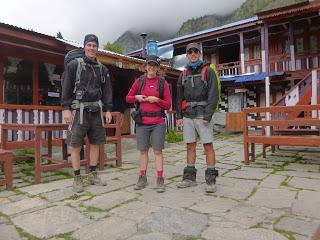
We chose the High Route because that’s the actual walking track and also because we wanted to take the chance to start getting used to altitude while getting nicer views during the day.
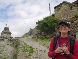

This was the first time we had to wear a jacket in the morning to fight the morning chill. But that coolness didn’t last very long. It felt like inside a steam oven as soon as the sun showed up. It eventually became the hottest day and the time that the sun was the strongest for the whole circuit. Therefore, that was the day we drank the most water and got the worst sunburnt. I got my wrists burnt and we both got the top of our ears burnt, parts of the human body that I never thought could get like that.
The day started with a relaxing twenty minutes walk on the flats of the Northern Dhikur Pokhari. and then the climb to Upper Pisang. This village is not much higher than the other one but the ascend is really steep.
Upper Pisang is a picturesque village that pretty much looks like many of the rural towns in the deep Spanish country. Masonry houses, goats wandering the streets and old ladies sitting on the streets and looking at the (very few) people around them as if they could analyse them and get to know their best hidden secrets in just one of their deep looks.
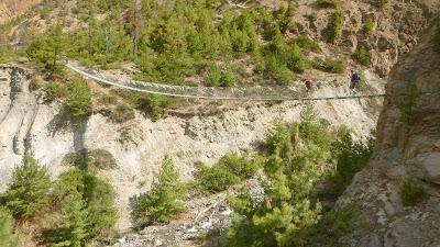
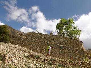
The next town in our route is Ghyaru at 3670m high and we found it even more picturesque than Upper Pisang. Or like hipsters would say, it was even more “authentic”.
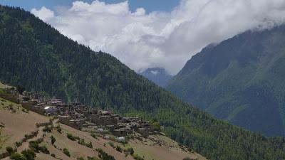
Ghyaru camouflages on a hill-side of a mountain. There’re only stone houses and most of them aren’t finished or maybe collapsed, we’re not sure about what term to use.
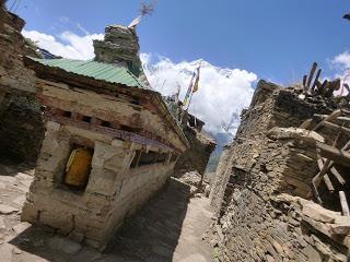
The streets are narrow and a few seem to have some sort of paving. This time we didn’t find any guesthouse or hotel of any type. For some reason, this place didn’t develop much the tourist business compared with any other town in the circuit.
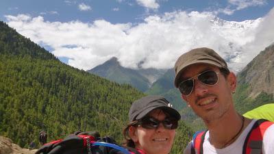
It was in this section of the track where we saw for the first time some summits of the Annapurnas. From near Ghyary we spotted the tops of Annapurna II (7937 m) and Annapurna IV (7525 m) and we can tell they were absolutely impressive.
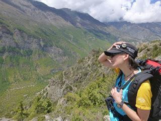
Just out of Ghyaru we met Ina, a Russian-Israeli girl that walked with us for the day, and Cristian, an industrial engineer from Chile who went to Kathmandu to show his Master Thesis on a conference and took the opportunity to do some sightseeing in the highs of the Himalayas. Eventually Cristian became the forth member of our tramping gang.
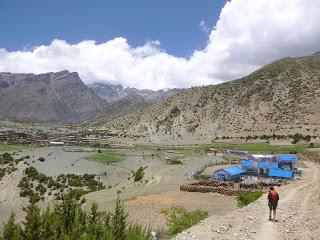
The track from Ghyaru descends as little as 10 m to Nawal (3660 m) which looks like a common place to end and start the day considering the vast amount of guesthouses we could find. A part from that, it didn’t feel much special.
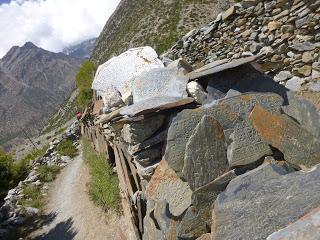
After Nawal, a downhill section coming from hell had been waiting for us, probably a really cool bit to do by bike instead of walking with huge backpacks. The track zig-zagged down a sandy hillside that turned out to be the garden or some sort of yard of the buddhist temple we saw at the very top.
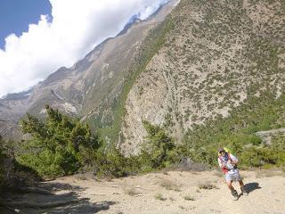
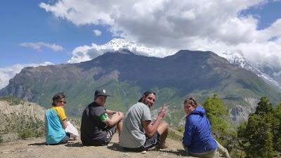
When we finally made it to the bottom, we could again choose between the low and straight way to Braka or an uncertain upper route that looked shorter on the map. For some reason up to date still to clarify, the five of us agreed on taking the upper trail that took us as high as 3800 m which was just what our sore legs needed to end such a cruisy day. However, even our legs were getting tired of our poor (or maybe masochistic) decisions our eyes got certainly rewarded with some of the best views we got during the circuit.
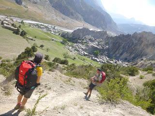
Latter on, when we all had our brains switched off and thinking about how the next guesthouse will be like and trying to decide between having a hot or cold shower while our legs were making their own decisions, we spotted the characteristic hills of Braka. For Enrique and me was almost like being at home because those hills look really similar to a massif near Barcelona called Montserrat where there’s a monastery and a basilica and constitutes a pilgrimage destination for Catholics.
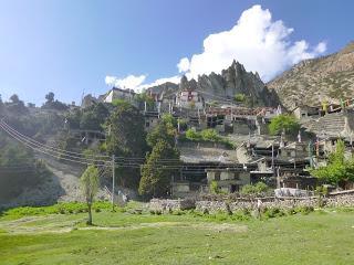
Braka is the town located at the bottom of a vertical rock wall the resembles a handsaw. It’s also popular thanks to its Gompa (temple) and because it’s only thirty minutes far from Manang which is the capital of the district and where the road ends. It’s highly advised in all guides to spend a day in Manang (3540 m) to get used to such altitude however we decided to stay in Braka, which is only 100 m lower which wouldn’t make much difference, because there were some good day walks we could start from there. These are also good well known alternatives do do on acclimatisation days no matter if you start from Braka or Manang. Of course that means that our acclimatisation days were not resting days but only backpack free days. Lots of people does rest (that’s why there’re lots of movie halls in Manang) but you obviously get ready for altitude better if you climb up to +4500m and then spend the night down rather than staying at a 3500 m drinking Masala tea on your acclimatisation day.
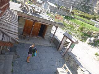
At the end of that day, Cristian and Ina kept had other plans went to Manang while we spent our night in Braka in the New Yak Hotel where we had some amazing spaghetti with tomatoes and mushroom that sat in out tummies so so so well. That was a great shot of energy that we’d definitively need to climb up to the Ice Lake at around 5000 m high. STAGE OVERVIEW:Date: 6 of June 2016Start time and altitude: 07:20 @ 3060 mFinish time and altitude: 16:00 @ 3439 mAprox. distance: 15 kmTipe of track: Rough trailClimate: Tropical turning to alpineWeather on the day: Hot and strong sun but clouds covering the surrounding peaks at timesAccommodation: Hotel New Yak. Free comfy room with double bed and ensuite toilet. Shared solar shower. Price of Dal Bhat: 450 RsEnrique & Marina
