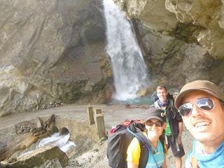
Los tres coincidimos al llegar a Dhikur Pokhari, este había sido un día muy duro que empezó con un poco de retraso porque tardamos en despedirnos de Shanti y de su cabra. Habíamos estado muy a gusto. Además, a Marina se le rompió el bocado de la camelback y empezó a salir agua buena disparada por todas partes. Esa valiosísima agua que cuidamos como si fuera oro porquéela pagamos casi a precio de whisky. Suerte que esto pasó todavía en casa de Shanti y ella misma nos hizo un apaño con esparadrapo. Ese día Marina bebió agua del grifo de Shanti con unas pastillitas de iodín por si se volvía a romper y perdía todo el agua.
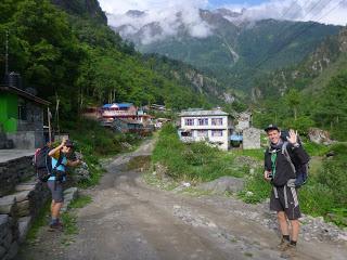
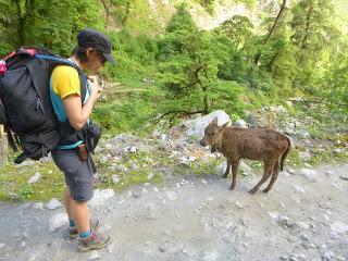
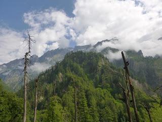
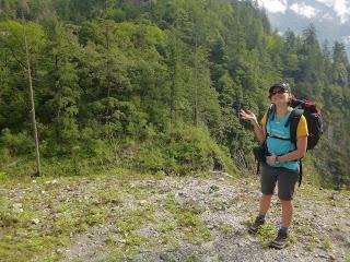
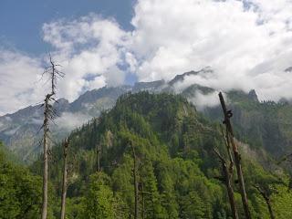
Abandonamos Danakyu por la carretera del infierno y vamos camino de Chame por una zona montañosa donde empezamos a intuir un cambio en la vegetación: empiezan a aparecer árboles con forma abetil por lo que pensamos que esto del calor sofocante se acabará pronto.
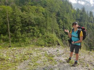
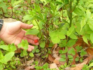
También nos encontramos con fresas silvestres por doquier, así que intuimos que nuestra suposición acerca del calor es algo errónea (y lo era).
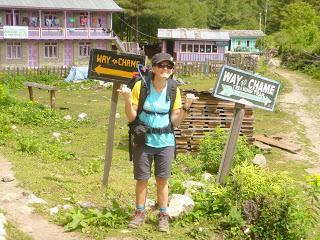
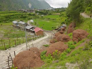
De camino a Chame pasamos por el asentamiento de Thanchow donde entramos en contacto con el divertido sentido del humor local en lo referente a las indicaciones para llegar hasta Manang.
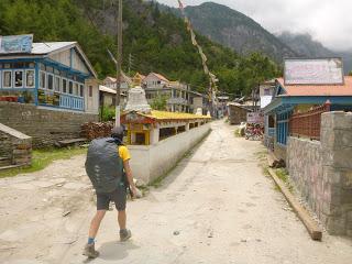
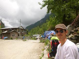
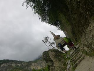
Chame nos recibió con la habitual construcción alargada llena de ruedas de oración con mantras gravados en sánscrito y también con una safe water drinking station.
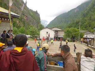
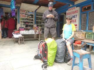
Aquí pudimos disfrutar de un intenso partido de volleyball (vimos un par de puntos sólo pero fueron largos intercambios, esta gente eran realmente buenos) junto a unos monjes y también encontramos una conexión a internet para Steffan, que tenía algún que otro problema con una aplicación que había cursado en la universidad de Múnich. Y es que, ¿a que no adivináis qué es Steffan? Ingeniero de Caminos. Si es que somos una plaga.
La despedida de Chame fue algo accidentada ya que unos niños nos pidieron chocolate y al decirles que no teníamos (y aunque tuviésemos no se lo habríamos dado, esto de mendigar por vicio es una costumbre muy fea adquirida por culpa de algunos turistas zoquetes) intentaron abrirle la mochila a Steffan. Les echamos un poco de bronca y lo siguiente que hicieron fue empezar a apedrearnos, y los niños nepalís, por mucho que sean de 4 o 5 años, pueden levantar piedras como si fuesen niños vascos.
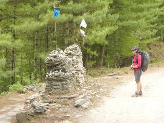
Durante el Annapurna Circuit se cruzan muchos puentes colgantes y no colgantes que tienen, algunos más que otros, un montón de Lungtas.
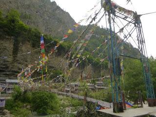
Las Lungta o banderas de oraciones son piezas tejidas en forma rectangular con algodón y teñidas de colores (blanco, azul, amarillo, verde y rojo) con imágenes, mantras y oraciones que están conectadas por su extremo superior con un largo cordel. Nos las hemos encontrado en puentes, guesthouses, ghompas, stupas, fuentes, laderas de montañas y casi hasta en los caballos.La palabra Lungta es la combinación de Lung (viento) y Ta (caballo) y es una criatura mítica tibetana de los tiempos pre budistas. El Lungta combina la velocidad del viento con la fuerza del caballo para llevar las plegarias desde la tierra hasta el cielo. La palabra Lungta para un tibetano representa fortuna y buena suerte. Los tibetanos creen que las plegarias y los mantras volarán con el viento y les llegarán a sus deidades que les enviarán a cambio buena suerte, felicidad y buena salud tanto para ellos como para su familia, amigos, conocidos y saludados (incluso a sus enemigos). Las Lungta representan paz, compasión, fuerza y sabiduría. Las Lungta que no se han desintegrado o volado durante un año se reponen con nuevas Lungta en el año nuevo tibetano. Esto no debe ser del todo cierto ya que hay puentes con tantas Lungta viejas, viejísimas y nuevas que casi no dejan ver los tensores.Una vez aprendimos el significado de las Lungta llegamos a la conclusión de que cuantas más banderitas tenía un puente más inseguro era cruzarlo.
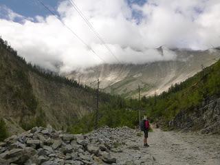
Después de un empujoncito llegamos hasta Bhratang donde descubrimos que lo único que había era una inmensa plantación de manzanos y lo que parecía el esqueleto de un nuevo hotel de gran lujo. Quedarse ahí a pasar la noche no era una opción por muy cansados que estuviésemos, así que seguimos caminando sabiendo que el próximo pueblo caía lejos.
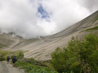
Antes de llegar a Dhikur Pokhari bordeamos el espectacular anfiteatro del Swargadwari Danda, con picos de entre 4600 y 4800 metros, que parece diseñado para descenderlo a toda velocidad en bicicleta si está seco, en una tabla si está mojado o esquiando si está cubierto de nieve.
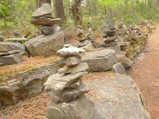
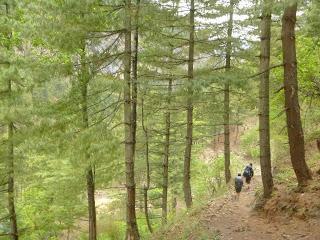
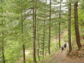
Cruzamos el río por el Swargadwari Bridge (que tenía muchas banderitas) y nos adentramos en un bosque parecido a los que tenemos en Nueva Zelanda a través del que llegamos a nuestro destino.
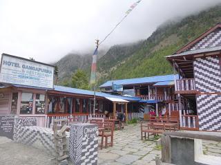
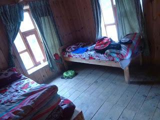
RESUMEN DE LA ETAPA:Fecha: 5 de junio de 2016Hora y altitud de partida: 07:40 a 2190 mHora y altitud de llegada: 17:00 a 3060 mDistancia: 25 kmTipo de vía: Carretera rural/camino 50/50Climatología: Tropical Condiciones meteorológicas: Más o menos soleado por la mañana y nublado desde mediodíaAlojamiento: Hotel Gangapurna Organic con cama gratis y lavabo compartido con agua caliente. Precio del Dal Bhat: 450 Rs
Enrique & MarinaEnglish versionANNAPURNA CIRCUIT DAY 3: DANAKYU (2190 m) - DHIKUR POKHARI (3060 m)
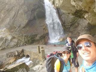
The three of us agreed in Dhikur Pokhari that it had been a really hard day. We started late because saying goodbye to Shanti, her family and her goat took us a bit longet than we thought it would. We felt really welcomed at her place. Besides, my camelback´s bite valve broke and water started flowing everywhere. That precious water that we treasure as if it was gold because we buy it for the price of whisky. I was lucky that we still were at Shanti’s when that happen and she turned into a little Nepali MacGyver and fixed it in a second with some tape. That day I drank water coming from Shanti’s tap with a couple of iodine pills, in case the valve would brake again and I lose all my water.
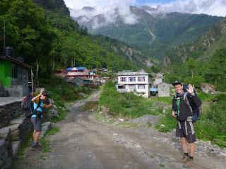
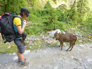
We left Danakyu walking on the evil road and heading to Chame. We could tell that the surrounding flora was progressively different than what we’d seen so far: we found the first alpine trees, no more banana or mango trees or marihuana. Thus, we hoped for the suffocation heat to go away soon.
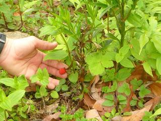
Also, there were loads of tiny wild strawberries growing on the side of the road and in the forest . That finding killed our hopes about getting some fresh temperatures some time soon.
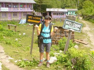
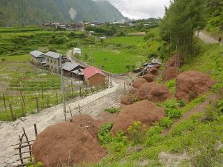
Half way to Chame we passed the little settlement of Thanchow where they either hate the neighbouring town of Manang and don’t want to send visitors there or should pride themselves for their hilarious sense of humour.
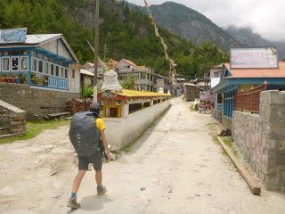
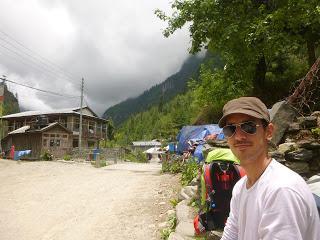
Chame welcomed us with the typical Buddhist player wheels (little metal cylinders embossed with mantras written in Sanskrit) and a safe drinking water station.
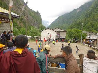
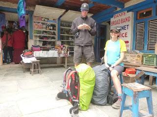
In the town centre we squeezed among the crowd watching a very intense volleyball match (according to Enrique and Steffan they were surprisingly good players) and we found a hotspot where Steffan could finally go on line to sort out some paperwork to carry on with his studies in Munich next school year. Funny enough, Steffan is studying Civil Engineering. We’re going to be declared a new pest very soon, wait and see.
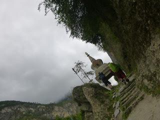
Our farewell from Chame happened to be a bit disappointing. In the outskirts of the village, couple of little kids asked us for chocolates and we told them that didn’t have any (the ACAP advices not to give local kids anything, anyway, because that would be encouraging bad habits like begging). After our negative they tried to open Steffan’s pockets and we obviously told the off. For our surprise, their reaction was to start throwing rocks at us and, although they weren’t older than maybe 5 years old, the rocks they threw were not their same size. We were just really lucky their aim actually matched a 5 year old kid.
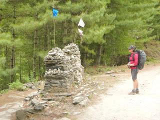
Along the Annapurna Circuit we crossed lots of hanging bridges and any sort of bridges or overpasses that always have at least one line of Lungtas hanging from them.
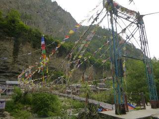
This Lungtas or prayer flags are rectangular pieces of cotton fabric dyed in white, blue, yellow, green and red. There’ve got pictures, mantras and prayers in Sanskrit printed on them and they’re all connected with some sting from the tops. They’re a constant feature everywhere in Nepal: bridges, guesthouses, ghompas, stupas, public fountains, hillsides, mountain summits… Just missing some in public toilets. The word Lungta is the combination of Lung (wind) and Ta (horse) and it’s the name of a Tibetan mythological creature from pre-buddhist times. Lungta combined the speed of the wind and the strength of horses to carry prayers from earth to heaven. Then, the word Lungta means fortune and good luck for people from Tibet. In Tibet, it’s believed that those prayers and mantras will fly with the wind and will reach the Gods. After, these Gods will send good luck, happiness and good health for them, their families, friends, people they know and even their enemies. Lungtas stand for peace, sympathy, strength and wisdom. Every Tibetan New Year, all Lungtas still standing get replaced with a new set. However, I honestly believe that not all of them are removed because we’ve seen some bridges with hundreds of Lungtas some very very old, some others just old and also a few new ones. Knowing all that, we figured out that the more Lungtas a bridge has, the more dangerous it is.
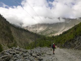
Pushing a bit we managed to get to Bhratang where there was a massive apple orchard and a building site of what looked like a big luxury hotel. Bhratang felt empty, unwelcoming and noisy and, even though we were tired and the next town was quite far, staying there wasn’t an option.
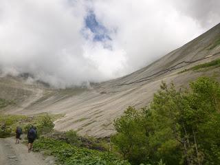
After the apple farms we walked at the bottom of an interesting geological form called Swargadwari Danda. It looks like an oversized natural bowl featuring 4600 and 4800 peaks that would be awesome to ride down on a bike when it’s dry, slide on a board when it’s wet or ski when covered with snow.
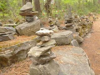
Later we took the Swargadwari Bridge (which had lots of flags) and crossed the river that led to a forest that reminded us of New Zealand bush and then to the day’s finish point.
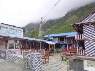
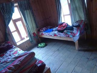
STAGE OVERVIEW:Date: 5 of June 2016Start time and altitude: 07:40 a 2190 mFinish time and altitude: 17:00 a 3060 mAprox distance: 25 kmType of track: Rural road/Track 50/50Climate: Tropical Weather on the day: More or less sunny in the morning and cloudy in the afternoonAccommodation: Gangapurna Organic Hotel. Free comfy room and shared washroom with solar shower.Price of Dal Bhat: 450 RsEnrique & Marina
