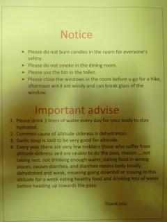
El mayor reto al que nos enfrentamos, y suponemos se enfrentan casi todos los excursionistas, al hacer el Annapurna Circuit es superar la paranoia que generan todas las advertencias sobre el muy temido mal de altura.
Preparando el viaje y posteriormente durante el circuito, al ver las sensaciones que se van teniendo, planificamos una, a nuestro juicio, buena aclimatación a la altitud. Las recomendaciones comúnmente aceptadas son: una vez pasados los 3000 m que la diferencia de altitud entre las paradas para pasar la noche no sea superior a 500 m (por experiencia podemos decir que 700 m están bien también), caminar más despacio de lo que las piernas quieren y muy importante, beber mucha agua.Seguir las recomendaciones es relativamente sencillo. En nuestro caso llevábamos cada uno dos litros de agua que recargábamos a medio día. Asunto acuático solucionado. A partir de 3000 m Marina pasó a caminar la última del grupo para que no nos hiciese ir demasiado deprisa. Asunto de la velocidad solucionado. Lo de los 500 m lo modificamos a 700 m pero en lugar de hacer “días de descanso en altura” nosotros optamos por hacer excursiones a gran altura o tomar rutas más elevadas para enlazar poblaciones. Y la verdad es que tuvimos una aclimatación perfecta.Antes hemos mencionado la paranoia por el mal de altura. Ese fue nuestro mayor problema ya que, con todo lo que habíamos leído sobre el tema, interpretábamos cada signo de cansancio como el prólogo de una evacuación de emergencia en helicóptero al hospital de Kathmandu y posterior muerte segura en una camilla con sábanas mugrientas en el pasillo del ala de urgencias. En cada pueblo, cada guesthouse, cada puesto del ACAP, cada puesto de la policía, en cada puente y casi hasta en la espalda de cada yak había advertencias y descripciones sobre el AMS (Altitude Mountain Sickness), HACE (High Altitude Cerebral Edema) y el HAPE (High Altitude Pulmonar Edema) que ponen los pelos de punta.AMS (Altitude Mountain Sickness): Los síntomas son dolor de cabeza, pérdida de apetito y náuseas. Si no se corrige a tiempo ya sea parando a descansar o descendiendo hasta el último lugar donde uno durmió bien desembocará irremediablemente en sus hermanos mayores el HACE, el HAPE o ambos. Para ayudar con los síntomas recomiendan un medicamento llamado Diamox. Las personas deportistas y en buena forma física son las más propensas a desarrollar un AMS ya que tienen el hábito de “forzar la máquina” y ejercitarse en lo que podríamos llamar agonía. La diferencia en altitud es que la concentración de oxígeno es menor por lo que la recuperación es mucho más lenta. Por este motivo hay que ir con mucho cuidado de no caminar al ritmo normal de excursión sino más lento, y eso cuesta.HACE (High Altitude Cerebral Edema): Aquí te explican que el cerebro está flotando en un líquido que se produce y se drena constantemente. Si subes demasiado rápido el conducto de drenaje se puede inflamar por lo que el líquido se quedará en la cabeza aumentando la presión intracraneal por lo que el cerebro no recibirá suficiente oxígeno de la sangre y dejará de funcionar correctamente. Los síntomas son fuerte dolor de cabeza, pérdida de equilibrio, vómitos, pérdida de agudeza visual y problemas de audición. La única cura es descender todo lo rápido que se pueda y, si pinta muy mal, tomar 8 mg de Dexametasona. HAPE (High Altitude Pulmonar Edema): La baja concentración de oxígeno y dióxido de carbono engaña a los vasos sanguíneos de los pulmones y estos creen que volvemos a estar en la barriga de nuestras madres por lo que se estrechan y minimizan la circulación sanguínea. El corazón seguirá bombeando como si no pasase nada, lo que acaba generando que los pulmones se inunden. El único síntoma es que te sientes débil y falto de aire, lo que es normal cuando estás caminando a 5000 m, para qué nos vamos a engañar. Si después de descansar estás aún peor entonces te ha tocado el gordo de la lotería, tienes HAPE sí o sí. La única solución es descender como alma que lleva el diablo y tomar 20 mg de Nifedifin.En caso de no saber lo que tienes recomiendan tomarse un cóctel Margarita consistente en 8 mg de Dexametasona, 20 mg de Nifedifin y una pastillita de Diamox y descender todo lo rápido que las piernas te dejen. En nuestro botiquín teníamos tiritas y paracetamol y claro, con este bombardeo de información no hay quien se relaje. Es por esto que hemos descubierto que el mayor problema cuando se está en la alta montaña es el casi desconocido HAP.HAP (High Altitude Paranoia): El HAP está clarísimamente motivado por la mezcla de un exceso abrumador de información, la sensación de que prefieres hacerte cortes con una cuchilla y bañarte en el Ganges antes que entrar en un hospital en Nepal y una cierta hipocondriasis que es directamente proporcional a los quilómetros que te separan de tu madre. La baja concentración de oxígeno hace que tardes más de lo normal en recuperarte de un esfuerzo. Caminar a 4000 m de altitud a unos 30 grados centígrados cargando entre 7 y 8 kg de peso cuando ya llevas varios días de dura caminata en las piernas cansa, es normal ir algo sofocado. El sol abrasador, el fuerte viento y el esfuerzo hacen que se note un poco la cabeza, lo mismo que si subes corriendo las escaleras de casa con las bolsas de la compra. Después de beber casi 5 litros de agua es normal que no apetezca una bandeja de arroz con lentejas (curiosamente unos espaguetis apetecen siempre). El tratamiento es sencillo, hay que saber escuchar al cuerpo, mantener la cabeza fría y poner a trabajar, en caso de tenerlo, el sentido común. Pues eso, que en lugar de las dos noches en Manang (3540 m) que recomiendan, nosotros nos quedamos en Braka (3439 m), subimos hasta el Ice Lake (4600 m) e incluso un poco más (5000 m) y bajamos a dormir esta vez ya sí a Manang con la fábrica de glóbulos rojos trabajando a tanto rendimiento que las células incluso crearon un sindicato que llamaron Unidos Podemos.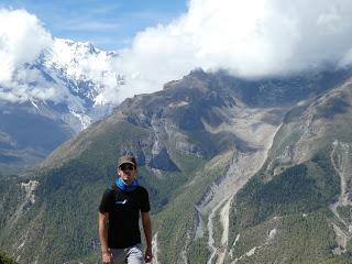
Los más observadores os habréis percatado de que las fotos en esta actualización prácticamente brillan por su ausencia. Después de tres días sin electricidad la batería de la cámara de fotos dijo basta. Pero Stefan aún tenía un poquito así que las pocas fotos de la excursión que hay por aquí son suyas.

Salimos de Braka sin las mochilas grandes camino al Ice Lake atravesando los campos que separan el pueblo de su famosa Gompa. Subimos por el mismo sendero criminal que habíamos descendido el día anterior y, pasadas un par de horas, nos dimos cuenta de que mi mochila goteaba. Llevaba la Camelback mal cerrada por lo que había perdido alrededor de 1 litro de agua. Menos peso que cargar, menudo problema.
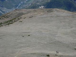
Llegamos al punto en el que el camino se separaba del curso conocido para ascender de forma casi vertical en dirección al monte Chulu (6584 m). Es un camino de cabras muy estrecho y arenoso que serpentea por la ladera de la montaña.
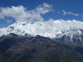
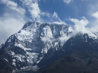
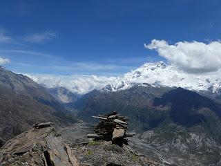
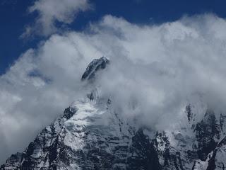
Tuvimos mucha suerte y durante todo el día pudimos ver las cimas del Annapurna IV (7525 m), el Gangapurna (7454 m), el Annapurna III (7555 m) y el Annapurna II (7937 m).
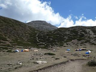
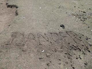
Pasadas unas tres horas de caminata llegamos a lo que parecía un campamento de transhumantes situado a 4100 m de altitud. En el suelo en letras bien grandes estaba escrito “DANGER”. Fue en ese punto cuando yo noté un poco la cabeza y desarrollé un HAP, por lo que frené el ritmo y seguí la ascensión a cámara lenta. Marina y Stefan siguieron a su ritmo.
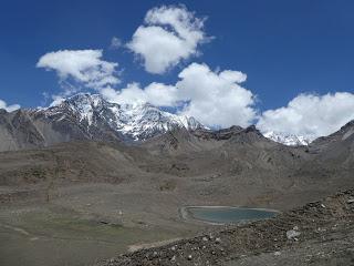
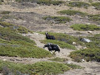
Pasado un ratito Stefan siguió a su velocidad pero a Marina le entró dolor de cabeza por lo que empezó a caminar detrás de mí. Vimos a Stefan desviarse del camino del Ice Lake y subiendo la ladera de la montaña en línea recta hasta que lo perdimos de vista. Allí, a 4600 m de altura Marina decidió que no seguía (también tenía un HAP) y se paró a descansar. Yo ya me encontraba perfectamente así que decidimos que yo seguiría las huellas de Stefan para encontrarlo y bajar todos juntos. Lo hice y, después de un gran esfuerzo, descubrí que estaba muchos metros por encima del Ice Lake (según el mapa llegué hasta algo más de 5000 m). No encontré a Stefan así que decidí volver con Marina, que todavía tenía dolor de cabeza, y bajar bastante rápido hasta Braka.
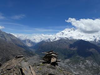
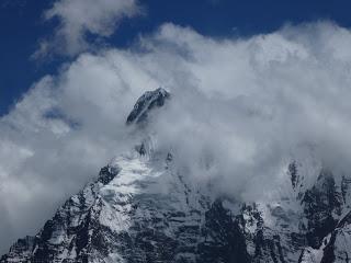
Una vez en Braka, donde teníamos las mochilas grandes, nos sentamos a esperar a Stefan tomando un té, no sin cierto nerviosismo. Dos horas más tarde lo vimos llegar rojo como una gamba y muy contento porque había hecho una cima de 5100 m. Resulta que no me lo encontré por allí arriba de milagro. En fin, le hicimos ver que lo que había hecho de separarse de nosotros había sido una tontería y, como buen alemán, lo entendió perfectamente y no lo volvió a hacer en todo el circuito.Cogimos las mochilas grandes y caminamos hasta Manang por lo que nos pareció una autopista. Aquella noche cenamos espaguetis con ajo y queso y descubrimos que la lactosa no se digiere muy bien a ciertas altitudes. El Método Científico y sus consecuencias.RESUMEN DE LA ETAPA:Fecha: 7 de junio de 2016Hora y altitud de partida: 07:40 a 3439 mAltitud máxima alcanzada: 5000 mHora y altitud de llegada: 17:00 a 3540 mDistancia: 10 kmTipo de vía: Camino de cabras y último tramo de carreteraClimatología: Calurosa alta montaña Condiciones meteorológicas: Sol abrasador con pocas nubesAlojamiento: Yak Hotel en Manang con cama gratis y letrina en la habitación. Agua tibia en la ducha. Precio del Dal Bhat: 450 Rs
Enrique & MarinaEnglish versionANNAPURNA CIRCUIT DAY 5: ASCEND TO ICE LAKE (4600 m)
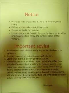
When in the Annapurnas the biggest challenge most trekkers face and ourselves among them was to deal with the paranoia that the constant warnings about altitude sickness will make you feel. We knew about the importance of acclimatisation even before going to Nepal. So when I planned the route from New Zealand, I took care not to set daily goals that would be unsafe altitude-wise. Therefore, we’ll get a good acclimatisation and we’ll go through the pass safely, just coping with the usual conditions of walking in highs. The usual advice includes not to sleep at an altitude 500-700 m higher than the night before once you’ve past 3000 m, never get out of breath which means walking at a slower peace than you normally would and, the most important, drink lots of water. Following these three basic rules is not a big deal. Regarding water, we generally carried two litres of water each and we would re-fill at midday and kept drinking while resting in the guesthouse. Regarding pace, even though I had been leading pretty much up to Braka, once we reached 3500 m I had to step to the back to not make the whole group walk too fast. I found really hard to walk at a slower pace and I had to concentrate not to speed up if I was at the front. It didn’t even work to walk in parallel with Enrique because I’d make him walk faster, so the only option was that I would stay at the bottom of the line. And regarding the length of the stages, we had already design them to not climb too much per day. However, our days were still long because we chose routes that would take us up to high altitudes to return back down to sleep. Following this three principles worked for us and we didn’t get sick. But that doesn’t mean we didn’t feel the altitude, which is a totally different thing.Nevertheless we’ve mentioned before the altitude sickness paranoia. Well, that was our real problem. After reading and hearing so many stories about the real sickness we took every sing of fatigue as the beginning of the disaster which would start with an heli evacuation to Kathmandu hospital and end with a certain death at the corridors of the emergency services area. In every single town after Dhikur Pokhari, every guesthouse, every ACAP post, every police station, every bridge and almost at every yak’s back we found signs describing and warning trekkers about the dangers of getting AMS (Altitude Mountain Sickness), HACE (High Altitude Cerebral Edema) and HAPE (High Altitude Pulmonar Edema).AMS (Acute Mountain Sickness): The symptoms are light headache, loss of appetite and light nausea. Unfortunately, it could be the beginning of much more severe symptoms and lead to HACE or HAPE or both if nothing gets done. AMS will cease by stopping the ascend, having a rest or even descending up to the last place where you felt ok. A medicine called Diamox is meant to help fighting the symptoms. Sporty and physically fit people tend to develop AMS the easiest because they’re used to push themselves hard and training while feeling breathless and almost agonising. However, in high altitude the available oxygen in air is less, therefore our bodies recover way slower or may not even recover (that’s when you do get sick). That’s the reason why high altitude is not the place to push hard but to keep a slow pace and a low heart beat. And that’s easier said than done. HACE (High Altitude Cerebral Edema): Our brains are apparently floating in a liquid that is constantly produced and drained away. Bad acclimatisation may lead to that drain to swell up and block and that will increase the pressure in the skull besides a lack of oxygen supply in the brain cells. The symptoms are strong headache, loss of balance, vomiting and others such as bad sight or loss of hearing or unreasonable behaviour. The only cure is to descend as fast as possible. In emergency cases a dose of 8 mg of Dexamethasone would help the hiker to descend to a lower altitude.
HAPE (High Altitude Pulmonar Edema): When your lungs feel the low oxygen and carbon dioxide concentrations in the air their the blood vessels get confused and believe you´re back inside you´re mum´s womb shrinking and minimising blood circulation to save energy. However, your heart will keep beating normally which eventually will flood the lungs. The only symptom is to feel weak, slow and out of breath. Unfortunately, that´s completely normal in altitude which makes really difficult to identify HAPE at an early stage. If after a good 10 minutes rest you´re not feeling better but worse, then start your descend with no hesitation and as fast as your legs and flooded lungs let you. A dose of 20 mg of Nifedifin may help you to reach lower altitudes. Summarising, don’t push yourself in altitude, listen your body and respect the time it may need to adapt to these new conditions. Otherwise you can be mistaking symptoms of serious sickness with plain fatigue. Although taking medicines should be the last option, in case of serious emergency some trekkers have to take a Margarita cocktail. Build in a tall glass 8 mg of Dexametasona, 20 mg of Nifedifin and garnish with a pill of Diamox. Take it in one go and start running down like there’s no tomorrow. We had tape, paracetamol, Voltaren and band aids in our first aid kit, so we were obviously getting really anxious about all this altitude sickness possibilities. Therefore, we’ve discovered the ultimate real mountain sickness which we’ve given the name of HAP. HAP (High Altitude Paranoia): It is clearly develop by the mixture of an excess of information regarding mountain sickness, the fear of going to a hospital where English is not going to be the doctors’ the first language and hygiene may not even mean anything for them and a certain level of hypochondria that is directly proportional to the distance away from our mums. It’s true that the low level of oxygen in air will make your recovery after an effort slower. Also, we all agree that walking at 4000 m high at 30 degrees celsius of temperature while carrying between 7 and 8 kilos at the back makes you feel tired. The scorching heat and the strong winds may make you feel your head a little bit, in the same way that you feel it after running upstairs with your grocery shopping on your arms. And after drinking as much as 5 litres of water, it’s normal that you may not feel like eating a cow or three top ups of Dhal Bat (spaghetti maybe?). The cure for HAP, though, is really simple: listen to your body and don’t push, keep your head cool and try to use that so called common sense that is rather uncommon these days. Getting back to the point, instead of staying in Manang (3540 m) we chose Braka (3439 m), climbed to the Ice Lake (4600 m) and a bit more (5000-ish m) and descend down to stay in Manang the second night of the acclimatisation stop.
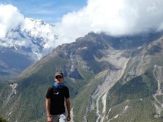
Ok, you’ve probably noticed that we don’t have many pictures in this post. Well, there’re two reasons for that. The first one is because no one want to see pictures of sick people about to die because they’ve got their lungs full of water. The second reason is that after three days with no electricity, our only camera ran out of battery. Luckily, Stefan still had some power left in his so he’s got all the credit for the pictures in this post.

In the morning, we left Braka only carrying day packs in our backs. We crossed the potato fields and walked beneath Braka’s famous Gompa, then walked up the steep killer hill that we knew from the day before. After a couple of hours, we noticed that Enrique’s backpack was wet and dripping. It’s normal to feel one’s back wet (it’s sweat) but not so much dripping. His Camelback wasn’t closed tight and had been leaking letting about a litre of precious water go. Well, less weight to carry, let’s look at the incident this way.
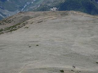
At some point the trail turns into a very steep and narrow track that leads to Mount Chulu (6584 m) zig-zagging up the hillside.
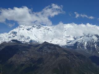
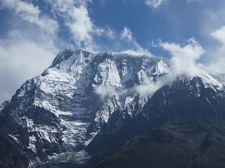
We were really lucky that Annapurna IV (7525 m), Gangapurna (7454 m), Annapurna III (7555 m) and Annapurna II (7937 m) showed up discontinuously during the whole day.
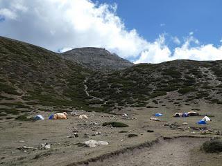
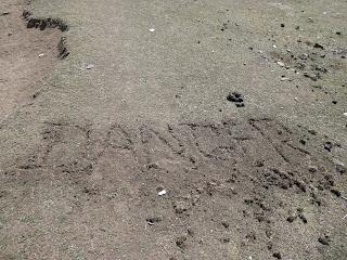
After three hours walking we got to what looked like a shepherds’ camp at 4100 m. Someone had left a note written in the dirt that read “DANGER”. Right there, Enrique felt a little bit his head and develop a HAP that made him ease his pace. Stefan and I kept our faster paces.
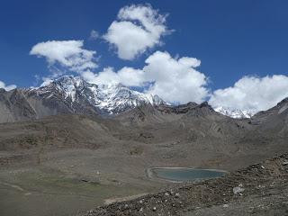
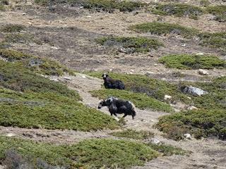
A while after, I started feeling my head too and decided to force myself to copy Enrique’s speed by walking behind him while Stefan kept going up. He took a wrong turn from the path that leads to the bottom of the lake and followed a track that went straight up the mountain and eventually out of our sight range. At around 4600 m I felt my head enough and didn’t want to go higher (I developed a clear HAP) and decided to stay a let my head settle. Enrique was feeling strong (he had been following a good slow pace for the whole day) and went chasing Stefan. A bit after, Enrique found the Ice Lake but realised that he was way higher than the lake itself (at about 5000 m) but no more signs of Stefan (so far he could see his footprints). At that point, he came back down to where I was and we both headed down to Braka.
In Braka, where our big packs were waiting for us, we waited for Stefan drinking tea out in the balcony that looked out towards the track and dealing with some reasonable anxiety. Two hours after, Stefan appear among the prayers wheels of the village, looking sunburnt but really happy because he summited a 5100 m peak. However, we told him off for splitting up without notice and, as the good German he is, he understood our point and didn’t do it again. Now that the family was reunited, we grabbed our luggage and walk the half an hour to Manang on what looked like a highway. That night we had spaghetti with garlic and cheese sauce and we found out the hard way that lactose becomes really hard to digest in altitude. STAGE OVERVIEW:Date: 7 of June 2016Start time and altitude: 07:40 @ 3439 mHighest altitude reached: 5000 mFinish time and altitude: 17:00 a 3540 mAprox. distance: 10 kmType of track: rough track and road from Braka to ManangClimate: MountainWeather on the day: Strong heat and few cloudsAccommodation: Yak Hotel. Free room with ensuite bathroom. Warm water available only in the common shower at this time of the year. Price of Dal Bhat: 450 RsEnrique & Marina
