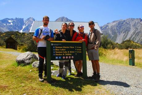
El día después de nuestra ascensión hasta el Mueller Hut decidimos tomárnoslo con algo más de calma, decisión que el viento no compartió por lo que se dedicó a soplar con todas su fuerzas. Por lo menos hacía sol.
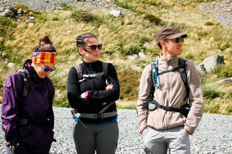
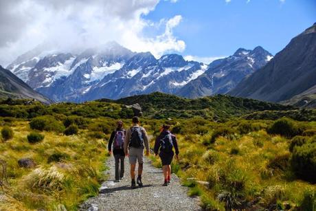
Empezamos el día caminando por el Hooker Valley, uno de los senderos más populares del parque nacional. Los del DOC tienen un caminito montado a través del valle que parece una autopista que, ahora en verano, está llena de chinos excursionistas. Estos chinos son distintos de los chinos que visitan ciudades porque, al no llevar viseras de plástico transparente, máscaras antiébola, guantes y un guía con paraguas, van algo más relajados e incluso saludan.
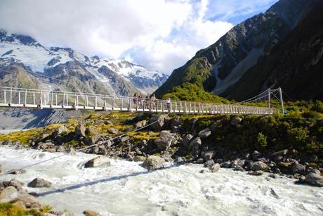
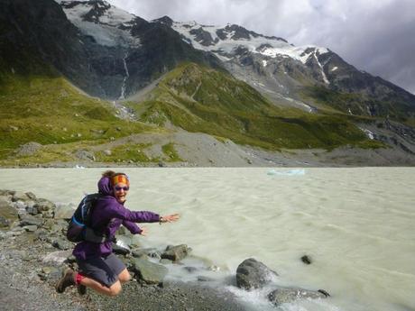
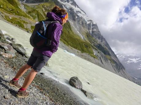
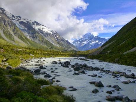
El camino transcurre a través de la típica vegetación subalpina de Nueva Zelanda y tiene un par de los típicos puentes colgantes que siempre encontramos por aquí. En este caso los puentes salvan el río Hooker, que es un río glaciar con un agua tan blanca que parece un batido de plátano.
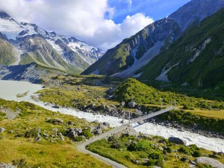
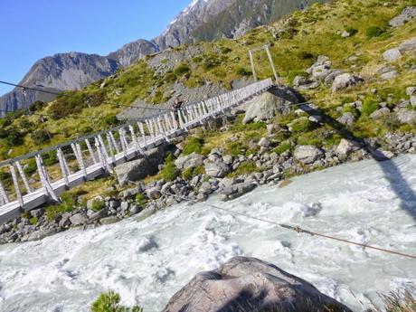
Entre la velocidad a la que baja el agua y el viento que hacía, cruzar los puentes fue toda una experiencia extrema. Este es uno de los encantos peculiares de Nueva Zelanda: cuando la climatología es adversa las actividades al aire libre se convierten en mucho más interesantes. Ciertamente si vas a cruzar unos rápidos utilizando un puente colgante apetece un poco de marcha, para paseítos uno puede irse a cruzar los puentes de Madison con Clint y Meryl.
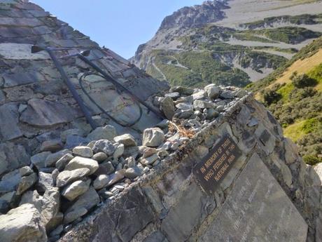
De camino al lago que se ha formado en el extremo del Glaciar Hooker debido a su rápido retroceso nos encontramos con el Alpine Memorial. Es una construcción de piedra en la que se rinde homenaje a los alpinistas fallecidos en el parque nacional, en la mayoría de casos ascendiendo o descendiendo el Mount Cook. Hay una plaquita de hierro por persona con el nombre, la edad, fecha, causa y lugar de la muerte. No contamos las placas, pero hay muchas. A pesar de no ser una montaña muy alta (menos de 4000 m), el Mount Cook representa un gran reto para cualquiera que quiera escalarlo.
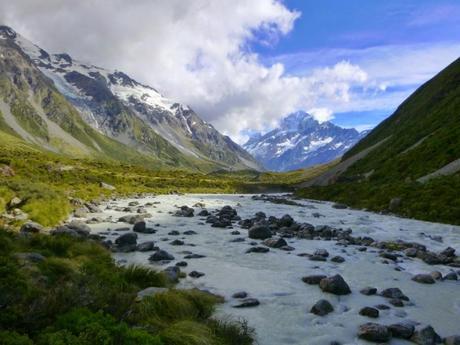
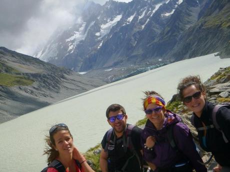
Finalmente conseguimos llegar al Hooker Glacier, que está justo debajo del Mount Cook, que está en medio de un montón de nubes. A veces pensamos que el Mount Cook es un poco como las meigas, que haberlas las hay, pero nadie las ha visto. Esto tiene una explicación.
Prácticamente la totalidad de las perturbaciones atmosféricas (tormentas y vientos) se acercan a Nueva Zelanda por el oeste. La Isla Sur se encuentra divida longitudinalmente por su columna vertebral, la cordillera de los Southern Alps o los Alpes Neozelandeses. Esta cordillera se encuentra muy cerca de la costa oeste, por lo que los vientos entran a tierra desde el Océano Pacífico y automáticamente chocan con las paredes verticales de más de 3000 m de altura de los Alpes. Las perturbaciones se deslizan por el extremo oeste de la cordillera ascendiendo hasta las cumbres y rebotando hacia atrás como una ola en una escollera, generando enormes nubes que cubren la costa oeste de la isla.
Este fenómeno es el causante de la gran diferencia climática que existe entre la costa este y la costa oeste de la Isla Sur: ambas se encuentran separadas por menos de 200 km, pero la costa oeste de la Isla Sur es la región con mayor precipitación anual del país (entre 6000 y 10000 mm) mientras que la costa este es la más seca (menos de 400 mm). Nueva Zelanda es también conocida como el “país de la nube blanca” debido a este fenómeno atmosférico. Muy interesante.
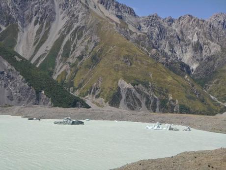
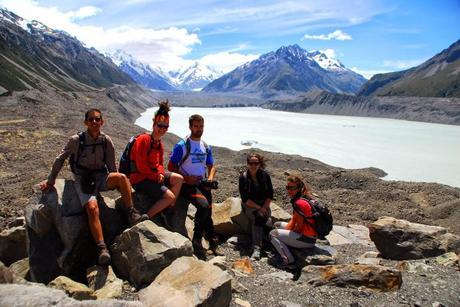
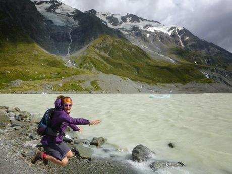
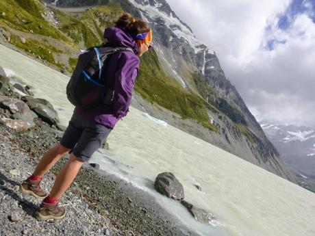
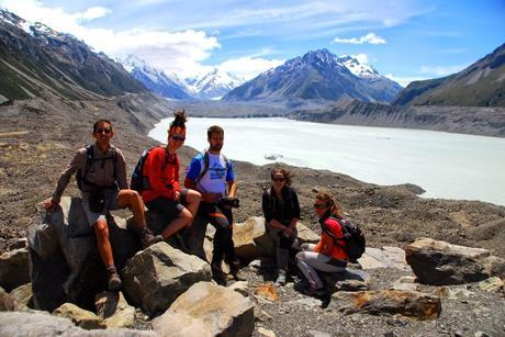
Una vez visto el Hooker Glacier decidimos ir a comer al Tasman Glacier, el glaciar más largo de Nueva Zelanda con 27 km de longitud. Como todos los glaciares, está retrocediendo a marchas forzadas, por lo que en el lago que se forma en su extremo inferior (Lake Tasman) hay impresionantes icebergs (léase áisbers).

Hemos tenido suerte de poder ver este glaciar ya que su retroceso se ha acelerado mucho desde los años 90, alcanzando una media de 1 km anual de retroceso. Se estima que desaparecerá por completo dentro de unos 10 o 20 años. Esto no es únicamente culpa del “camibo climático” sino que está relacionado con el gran terremoto de 2011, que precipitó 40 millones de toneladas cúbicas de roca y tierra sobre el Lake Tasman que generaron tsunamis de casi 4 m de altura que erosionaron la parte inferior del hielo del glaciar, acentuando su retroceso.Ya de vuelta a casa paramos en Cromwell, pueblo famoso por sus melocotones, albaricoques, nectarinas, cerezas y ciruelas. Compramos albaricoques con los que Marina ha hecho conservas y unos cuantos melocotones que, a pesar de estar riquísimos, no alcanzan el nivel de los melocotones de Calanda. Enrique & MarinaEnglish versionAORAKI / MOUNT COOK NATIONAL PARK – HOOKER VALLEY AND TASMAN GLACIER
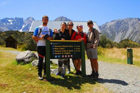
The day after the Mueller Hut expedition we decided to go for something a bit more relaxed. Moreover, the wind didn’t agree with our decision and was blowing like crazy from all directions. At least it was very sunny.
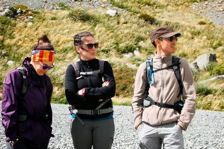
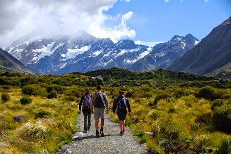 We started the day walking through the Hooker Valley, one of the most popular walking tracks in Mt Aspiring National Park. The DOC has a well looked after path crossing the valley that now in the summer seems like a highway full of Chinese tourists. This type of Chinese tourist is a different sub-type than the ones visiting cities because they don’t wear translucent plastic caps, anti-Ebola masks, gloves and they don’t follow a guide carrying an umbrella. This is a more relaxed type and they say hello when you walk past them.
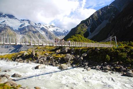 The track crosses the classic sub-alpine flora of New Zealand and there’re a few of these typical hanging bridges that DOC builds to cross fairly big rivers. This time the river to be crossed is called Hooker and its water is so white that looks like a banana smoothie with bubbles and everything.
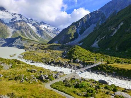
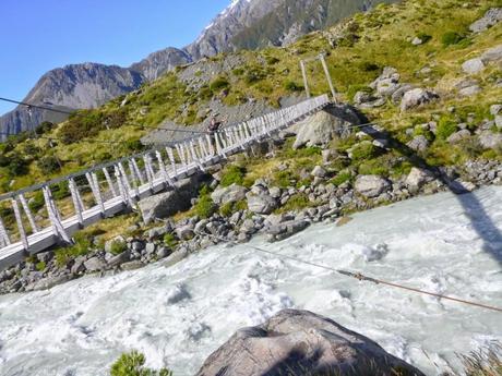 Between the speed of the water flow and the extreme wind, crossing the rivers almost became a risky experience. This is probably one of New Zealand’s charms: when the weather is bad, any outdoor activity becomes a mission, even taking the wheelie bins down the driveway.
 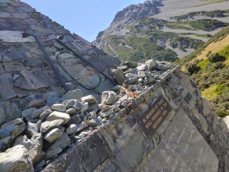 On the way to the lake formed by the melting and recoiling process of the Hooker Glacier we found the Alpine Memorial. This is a stone construction to honor those mountaineers who died in the National Park, in most cases, on their attempt to climb Mt. Cook. There’s a metal plaque per person with their name, age, the date and cause and place of their passing . We didn’t count the number of them, but there were lots. Although Mt. Cook is not a very high mountain (less than 4.000 m), it’s considered a serious challenge even for well experience climbers.
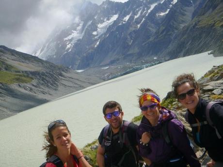 Finally, we managed to get to the Hooker Glacier, located just under Mt. Cook, always covered with one or other cloud. You could think about Mt. Cook like you do about Father Christmas: you know he exists but you’ve never seen him. There’s an explanation for that.
 Almost all the atmospheric alterations (mostly thunder and wind) approach New Zealand from the West. Furthermore, the South Island is divided longwise by its spinal cord: the Southern Alps. This mountain range is located very close to the West Coast, so the winds coming from the Pacific Ocean hit the 3.000 vertical walls of the Alps straightaway. Then, the meteorological effect slides down through the West side of the range climbing up the summits and bouncing down again like waves in a seawall. The final effects are massive clouds covering the West Coast of the island nearly all the time and, therefore, rain. Such character makes the West Coast of New Zealand be known as the Wet Coast.
 That situation is the cause of the big difference in weather between the West and East Coasts of the South Island although they’re just 200 km a part. The West Coast is the region that gets the largest annual rainfall in the whole country (between 6.000 and 10.000 mm) while the East Coast is the driest part (with less than 400 mm). The Maori name of the country actually comes from this effect: Aotearoa or the Country of the White Cloud.
 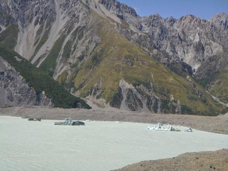 After this meteorology lecture, let’s get back again to the sightseeings. Once the Hooker Glacier was checked, we went for lunch to the Tasman Glacier, the longest in New Zealand with 27 km of length. It’s also moving backwards very quickly like all other glaciers, reason why there’s a lake forming in the lowest part of it (Lake Tasman) with icebergs floating in the surface.
 We should feel very lucky to see this glacier as the backing up process is going at a very high speed and it’s been accelerating since the 90’s, reaching a speed of 1 km/year backwards. The experts estimate the glacier will be gone in about 10 or 20 years. However, this is not only due to the famous “climate change” but also related with the 2011 earthquake which was the cause of 40 million tons of rock and sand falling into the Lake Tasman. This rock fall originated several tsunamis with 4 m high waves that eroded the lower part of the glacier ice and, obviously, contributing to its damage. Finally, on our way back home we stopped in Cromwell, town renowned for their quality stone fruit. We bought apricots that I’ve already eaten or preserved in light syrup and some peaches that are way nicer that the supermarket bought type but they’re still not as tasty as the D.O. of Calanda. Enrique & Marina
