
Y llegó el día. El lunes habíamos ascendido la cima este de la Sierra y el martes habíamos comprobado que el bosque del extremo oeste era atravesable ya que la pared de la última cima parecía asequible.

Camila, Marina y yo nos preparamos para la aventura del miércoles: recorrer todas las cimas de Sierra Contreras.


Salimos a media mañana del campamento y nos dirigimos hacia el pico este de Sierra Contreras. Seguimos el camino que habíamos abierto el lunes, que esta vez se nos hizo más corto. Ahora el viento pegaba mucho más fuerte, hasta el punto de hacernos plantear la retirada.

Fuimos escalando, esta vez haciendo gran parte de la ladera a gatas o directamente reptando, hasta llegar al lago. Una vez ahí ascendimos hasta la cima para empezar la travesía oficialmente en la cima este de Sierra Contreras.

El viento era muy fuerte pero las cimas de la sierra están enlazadas por terreno más o menos llano y ancho por lo que no era arriesgado caminar por ahí.

El paisaje era irreal: extremadamente árido, todo formado por rocas rotas, sin nada de vegetación. Igual aquí rodaron el aterrizaje en la luna.
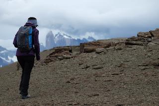
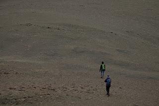
Fuimos enlazando cimas hasta llegar a la séptima y última, desde donde la panorámica de las Torres, la Laguna Azul y todo el valle de las Chinas es espectacular.


Y tocaba bajar. Fuimos siguiendo caminos de guanaco con mucho cuidado. La ladera era realmente empinada y el terreno era muy inestable, con rocas cayendo constantemente.

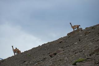
Llegamos hasta la primera de las paredes y la descendimos in problemas por donde vimos caca de guanaco.


La segunda pared ya fue otra historia. Costó bastante encontrar un buen sitio para salvar el desnivel: Marina de hecho tiró la mochila y descendió como si estuviese en un rocódromo. Yo tuve algo más de paciencia y encontré una zona algo más practicable, pero no mucho más.


Una vez pasada la segunda pared el camino hasta el claro en el que habíamos estado el día anterior fue coser y cantar.


Seis horas después y habiendo recorrido casi 14 km con un desnivel de 1000 m llegamos de vuelta al campamento.
Enrique & MarinaEnglish versionSIERRA CONTRERAS TRAVERSE

On Monday we climbed the first peak at the East end of Sierra Contreras. On Tuesday we walked up the forest on the West end of the range up to the clearing and checked the vertical wall located at that end that would lead to the summit.

On Wednesday the attempt was to walk up to the top on one end and traverse to the other edge of the range, summiting all the peaks.


Camila, Enrique and I left the camp at middle morning after having a good breakfast. This time we had to ask the boys to keep Ramers, the camp’s dog, not to come since she’ll definitive struggle in many sections of scrambling. We took that guanacos’ path we knew from a Monday to reach the peak at the East End of Sierra Contreras. As we knew the way, the ascend felt way shorter. However, the wind was stronger and pushed as very hard to even consider to refrain from the adventure.

We scrambled up nicely. This time we were ready with our globes, not like Monday, and made it to the lake in not much time. From there and after taking a few pictures we officially started the traverse from the East End of Sierra Contreras.

The wind was the strongest we’ve seen on a mountain but the crest was wide and more or less flat so it was really safe to walk on it.
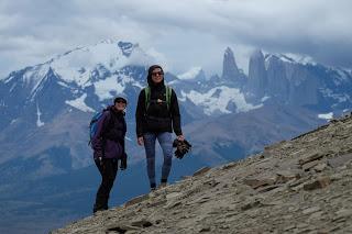
The scenery looked absolutely surreal: very arid, broken stones covering the ground, not a single mark of vegetation up there. That could have been the set up for when the NASA recorded the landing on the moon.
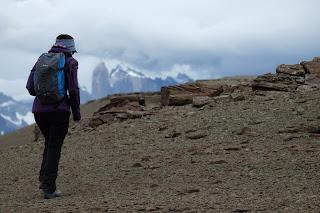

We walked from one peak to another until the seventh and last one where the views of the Towers, Laguna Azul and the Chinas Valley were absolutely spectacular.


Now we had to start going down. We followed some guanacos’ path very carefully. The slopes were really slippery and steep and even the larger rocks that look firmly attached to the ground could fall if you step on them.


We got to the first vertical wall and managed it really easily as we found a guanacos’ trail again.


The second wall was a different story. It was harder to find a good section to climb down. I found a doable place and started climbing down but eventually the backpack was bothering me and I had to throw it down. I would have appreciated a rope and a harness at that point but I made it down safe and sound anyway. Enrique chose a different route that was a bit better and Camila, of course, preferred that one too.


After the second wall we only had an extended slope of loose rocks that led to the Windy Clearing we already knew.


About six hours after leaving, we arrived back at the camp. We had covered 14 km and 1000 m in altitude gain. Enrique & Marina
