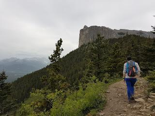
Yamnuska es el nombre que la tribu de los Nakoda dan al Mount John Laurie y se traduce como “el muro de piedra”. Los Stoney Nakoda First Nations pidieron dar oficialmente el nombre de John Laurie a Yamnuska en 1961, dos años después de su muerte, como símbolo de agradecimiento por todo el trabajo que realizó en favor de su causa, fundando la Indian Association of Alberta.Y un muro de piedra es lo que es Yamnuska. Visto desde el inicio del ascenso parece inexpugnable, pero tiene truco: el camino sube por la parte de atrás, que no es completamente vertical. Para que os hagáis una idea de cómo es la pared frontal: se le considera la joya de la corona de las Rocosas Canadienses para los escaladores, con más de 130 vías de ascenso.
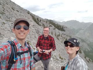
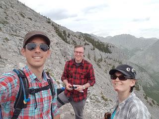
Empezamos la caminata Jeff, Marina y yo bajo un sol de justicia. Y las Rocosas no son Nueva Zelanda o el Pirineo; esto es un poco un sálvese quien pueda. La gran mayoría de excursiones son un poco a lo Juan Palomo: ellos te dan un sitio para dejar el coche, tu ves donde está la cima a la que quieres llegar y… ya te apañarás. Aquí le llaman “route finding” o “navigating required” que significa que el sendero no está marcado. Al principio la verdad es que molesta un poco porque en el fondo no cuesta nada poner unos triangulitos naranjas o hacer unas marcas con pintura, pero una vez uno se acostumbra es hasta entretenido.
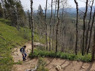
Estábamos los tres subiendo, más o menos siguiendo el camino (que no esté indicado no significa que no se vea, aquí la gente sube montañas como quien va a comprar el pan) hasta que llegamos al final del bosque. Justo en el punto en que empieza el “scramble” (aquí en las rocosas las excursiones se dividen en “hikes” o caminatas y “scrambles” o zona de trepar) el cielo se encapotó y Jeff recibió una alerta en el móvil: gran tormenta acercándose. ¡Rayos y retruécanos!Aceleramos el paso justo en una zona que es como dos Pedraforcas. En fin, hicimos lo que pudimos para llegar a la cima.
Llegamos a la cresta de la montaña, zona de más o menos un metro de anchura donde se encuentra la pared vertical que se ve desde la carretera con la pared casi vertical por la que subimos.
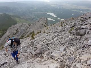
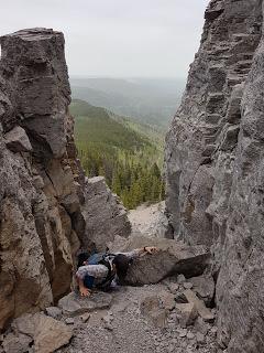
El cielo estaba bastante negro y olía a ozono que daba gusto. Aceleramos un poco más y llegamos hasta el paso complicado de la excursión: unos 30 metros de infarto en los que hay que asegurarse a unas cadenas para poder caminar por unas rocas de no más de medio metro de anchura. Una vez allí, los primeros rayos e inmediatamente los primeros truenos.
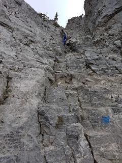
La cosa no pintaba nada bien; se levantó mucho viento, empezó a llover y los truenos se iban acercando. Teníamos dos opciones: seguimos subiendo y bajamos por el otro lado (esto era el plan inicial ya que la ascensión a Yamnuska es en realidad un recorrido circular) o nos damos la vuelta y bajamos pitando.Optamos por darnos la vuelta ya que, pese a que el camino era muy empinado y pedregoso, sabíamos exactamente cómo era por lo que teníamos una idea de qué esperar. A veces hay que ser más valiente para darse la vuelta que para continuar ascendiendo.
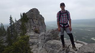
En fin, no llegamos al punto más alto de Yamnuska por escasos metros pero al menos no nos pasó nada. Una vez dejamos el pedregal atrás la tormenta cesó y, al llegar al coche, hacía otra vez un sol abrasador. Cosas de las montañas.
Enrique & MarinaEnglish versionHIKING IN KANANASKIS: MOUNT YAMNUSKA (2240 m)
Yamnuska is the Nakoda people’s name for Mount John Laurie and literally translates for “rock wall”. The Stoney Nakoda First Nation asked to officially give the name of John Laurie to this mountain in 1961, two years after his death, to acknowledge all the work he did to support them which included the creation of the Indian Association of Alberta. But if you look at the mountain from Exshaw, Yamnuska really looks like a rock wall. From the bottom the peak seems unreachable, but the trick is that there’s an easier route at the back while the front is considered the pearl of the Canadian Rockies with over 130 technical rock climbing routes.
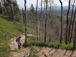
Jeff, Enrique and I started the climb under an unusual toasty sun. As opposed to New Zealand or the Pyrenees where the tracks are marked, in Canada you always have to find your own way. In most trails, there aren’t any official indications other than the place where to park your vehicle and a screen with a simple map. Therefore, you always have to be ready to find your own route, turn back if it doesn’t feel right and basically be able to navigate in the mountain. For the first few times it was a bit annoying but now it’s kind of fun and keeps you more focused on the hike.
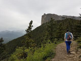
We were on the way up, pretty much at the end of the forest line when suddenly the sky got covered with grey clouds. At the same time, Jeff received a weather alert in his phone. It said there was a thunderstorm getting close to the peak and, although we knew that bad weather was going to hit the area in the late afternoon, it seem too early for it at that point. We were only at the beginning of the scramble and we decided to carry on but just a bit faster thinking that it was just going to be cloudy.
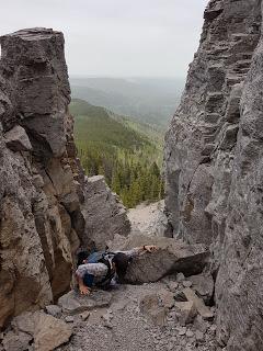
We reached the ridge which is about 1 meter narrow and provides with spectacular views of the Bow valley when you’re looking over the vertical side of the mountain.
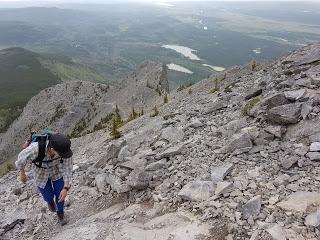
The sky kept turning darker and we could even smell the humidity in the air. We were going at a pretty good pace but the scramble required some time. Also, we reached a section in which you have to hold on to a set of chains fixed to the rock and walk over a narrow rocky edge. Right at this point we could heard the first thunderclaps and see the first lightnings without much time in-between each other.
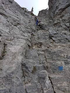
The situation didn’t look appealing up there: on top of the thunder, it was windy and the rain was starting to fall making the rocky edge even more slippery. We knew we were just below half way so we had two options: carry on forward and make our way down through the summit and the chained section and completing the loop or go down the same path we came from which we knew was going to be more or less safe and easy in case the rain hits hard and that would take us away from the exposed part in a reasonably short time. The ones who know us can probably guess what we did. We’re pretty conservative in this matters, so it shouldn’t be a surprise that we turned around and went back down the steep but well known way we just came up on. Very often it’s harder to take the decision to turn back to safety than to carry on and finish your ascent.
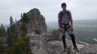
In any case, we didn’t make it to Yamnuska’s summit this time for a few meters but we’re glad we weren’t in serious danger at any point. Actually, just after we past the scramble the thunder was gone and by the time we reached the car the sun was again shining and we needed a second layer or sunblock. Isn’t it amazing?Enrique & Marina
