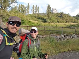
Al llegar de Candanchú y comprar las plantillas para las botas de Marina, los zapatos mágicos que le diría su mamá a Forrest Gump, pensamos que el problema se había acabado, pero era demasiado tarde. Marina ya se había hecho una lesión incómoda en los talones así que decidimos volver a casa a descansar y coger los crampones que sabíamos que íbamos a necesitar para el Collado de Piedrafita/Tebarray. Así que llamamos a mis padres y nos vinieron a buscar a Sabiñánigo desde Barcelona.
Volvimos a Sallent de Gállego una semana después, justo la noche de la inauguración del Festival de Música Pirineo Sur. Qué puntería; pasó lo mismo que con la Irati Extrem en Ochagavía, el pueblo estaba colapsado. Afortunadamente tenían habilitada una zona de acampada a medio camino entre Sallent de Gállego y Lanuza donde pudimos montar la tienda justo antes de que cayese el diluvio universal y ahogase a todos los hippies que no habían puesto el cobertor de la tienda porque querían dormir bajo un millón de estrellas. Cosas del karma.
Aquella noche dormimos fatal ya que la zona de acampada estaba en la ladera de una montaña, suponemos que para que no se acumulase agua (llueve cada tarde en verano), y porque evidentemente la gente que va a un festival de música no se va a dormir a las 22:30 como nosotros.
Nos levantamos pronto por la mañana, sin haber pegado ojo, y recogimos la tienda que estaba empapada porque no había parado de llover en toda la noche (dentro se estaba seco y calentito, la tienda es de buena calidad). Caminamos hasta la plaza de Sallent de Gállego y nos acabamos las pizzas de la noche anterior con los primeros rayos de sol.
El camino sigue el río Gállego hasta llegar al embalse de La Sarra, que tiene una zona de picnic donde Marina confundió los contenedores de reciclaje con tiendas de campaña por lo que estuvo unos minutos fastidiada porque pensaba que podíamos haber acampado ahí en lugar de en el festival.
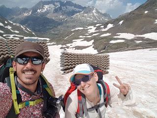
Desde el embalse se entra en el Valle de Aguas Limpias por el que se sube hasta el Refugio de Respomuso, al que todo el mundo llama de Respumoso así que igual empezamos una campaña en change.org para que le cambien el nombre. Llegamos al refugio de tan difícil nombre a las 12 justo a la vez que un chico de nacionalidad indeterminada muy parlanchín que se empecinó en repetir que él no estaba siguiendo la GR11 sino la HRP (Haute Route des Pyrennes), o ARP en castellano, motivo por el cual le bautizamos como “el HRP”, que se pronuncia “el jarp”.
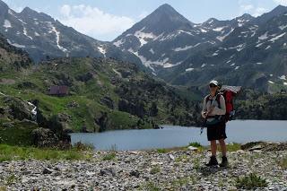
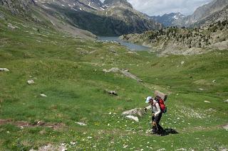
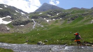
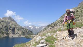
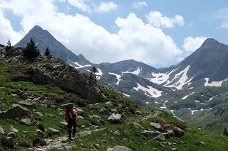
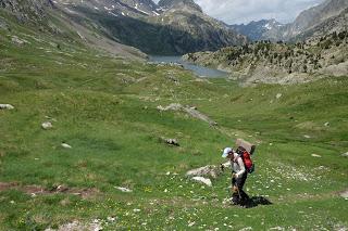
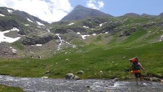
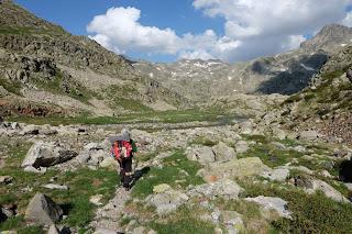
De Respomuso subimos hacia el Ibón de Llena Cantal por un terreno formado por praderas verdes de anuncio de suavizante.
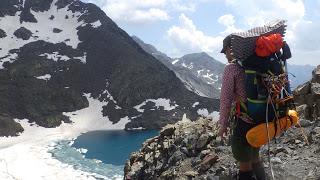
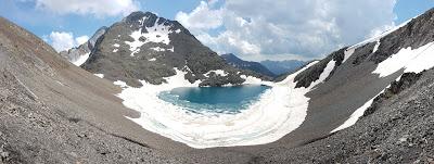
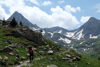
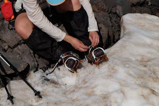
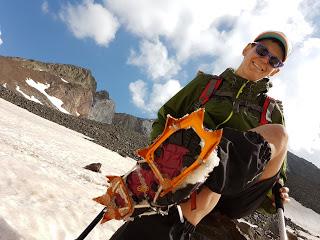
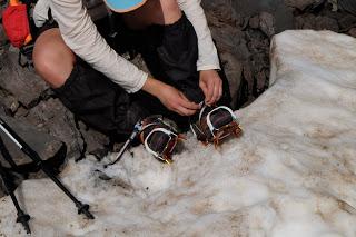
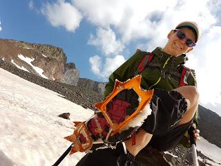
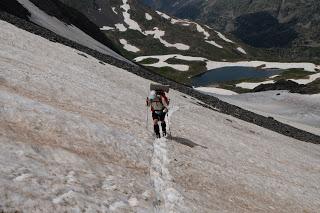
Una vez pasado el ibón empieza la nieve, el hielo y las piedras. Nos pusimos los crampones y empezamos la ascensión hacia el Collado de Tebarray o Piedrafita (2771 m).
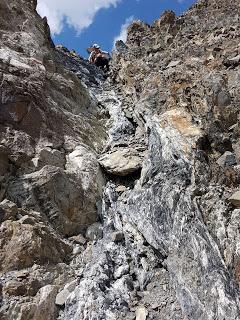
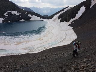
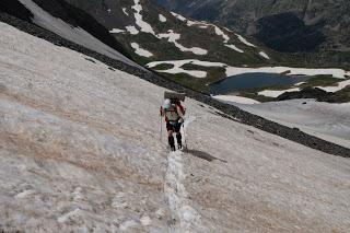
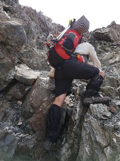
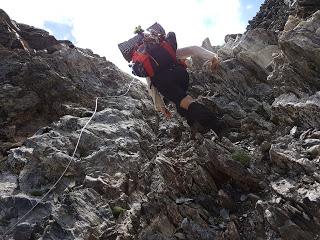
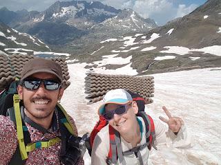
Avanzamos lentos pero seguros asegurando bien los bastones y los pies hasta que llegamos a la parte complicada del collado. La pendiente se hace tan pronunciada que la nieve ya no se aguanta al terreno por lo que el terreno rocoso aflora.
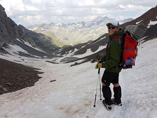
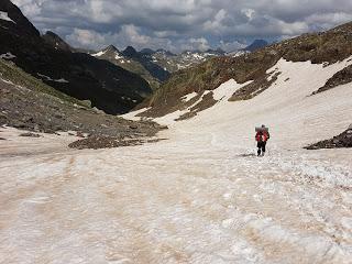
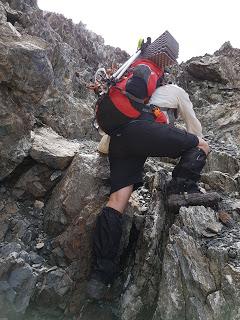
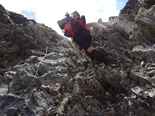
Conseguimos asegurarnos en las rocas y nos quitamos los crampones en un ejercicio que si lo hubiésemos grabado nos habrían fichado los del Circo del Sol. A partir de ahí se hacen los últimos metros de ascensión por roca. Hay unas cadenas puestas pero para subir no hace falta agarrarse, para bajar probablemente sea una buena idea agarrarlas hasta con la boca.
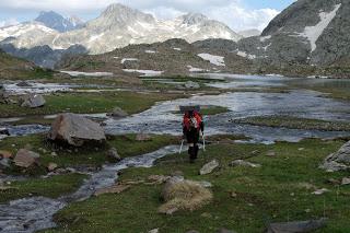
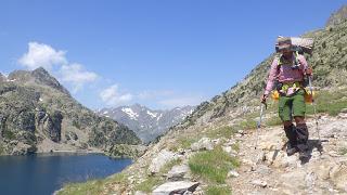
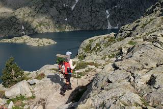
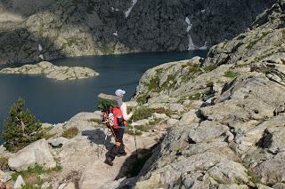
Una vez en el collado toca bajar bordeando el Ibón de Tebarray, que todavía tenía mucho hielo, hacia la Boca del Infierno, puerta de entrada al Barranco de Piedrafita, que es precioso, por el que se desciende hacia los Ibones de Bachimaña (el Alto y el Bajo, como en los anuncios de Fairy).
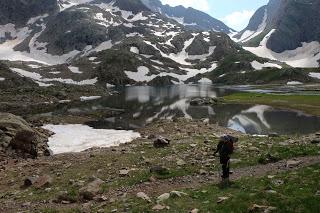
La bajada por el barranco es larga y había bastante nieve así que también la hicimos con crampones.
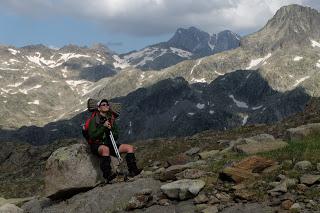
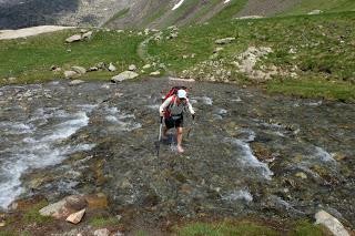
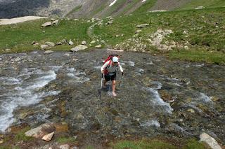
El camino es inexistente así que uno va por donde puede, guiándose un poco por los hitos de piedras que gente con más tiempo que nosotros ha ido haciendo y por la lógica de seguir el curso del río, que sabíamos que iba hasta el ibón de Bachimaña Inferior, igual que nosotros.
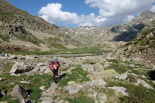
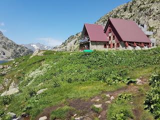
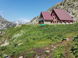
Llegamos al refugio de los ibones de Bachimaña bastante cansados después de caminar durante 11 horas así que nos compramos unos Aquarius, la bebida del viaje, y unas galletas Príncipe. Montamos la tienda cerca del refugio y nos fuimos a bañar al ibón y luego a cenar y a dormir.RESUMEN DE LA ETAPA:Fecha: 14 de julio de 2018Hora y altitud de partida: 08:00 a 1288 mHora y altitud de llegada: 19:00 a 2175 mDistancia: 22 kmDesnivel acumulado: +1635 / -800Tipo de vía: Sendero, nieve y rocasMeteorología: Despejado con tormentas por la nocheAlojamiento: Acampamos cerca del Refugio de Bachimaña (guardado)
Enrique & MarinaEnglish versionPYRENEES TRAIL GR11 STAGE 9: SALLENT DE GÁLLEGO - REFUGIO DE BACHIMAÑA
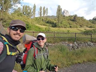
On the evening we arrived in Sallent and got the gel insoles for my boots, we thought that the problem with my feet would be over. They felt more comfortable although still not quite well but it was the end of a long day so I though the pain will go away overnight. Unfortunately, the next day I could still feel exactly the same unbearable sharp pain breaking through my heels, feet balls and big toes. We looked closely to notice that I had bruises in many parts of my feet soles. I quickly checked with the local doctor who said that the only thing we could do was to rest for a few days and let the bruises heal. We took the opportunity to go back to Barcelona, rest at home and pick up the crampons since we knew they’ll be required to cross Piedrafita/Tebarray’s pass. Luckily we could take a bus to Sabiñánigo where Enrique’s parents drove from Barcelona to pick us up.
Exactly a week after we went back to Sallent de Gállego on the night that the Music Festival Pirineo Sur was opening. Again, of course, we’ll have to deal with a busy town like Ochagavía while hosting the Irati Extrem. On the bright side, they had set up an camping area to fit the audience overflow. That was located in a grassy block between town and Lanuza, which is the neighbourhood where the concerts take place every year. We got to Sallent with just enough time to build the tent and get in to skip The Flood.
There, we had one of the worsts nights over the whole trek. The site was on a steep hillside, which was good to help the drainage but made us slide downhill on your sleeping mat. Enrique was particularly uncomfortable with this. Also, there was an extra bright floodlight left on during the whole night that didn’t help us to close our eyes. However, it was the crowds’ noise that bothered me the most. The flattest site we could find was just in the edge of the block, very close to the road where people walked past to go from town and to Lanuza stage. So I could clearly hear all the conversations, screams and laughs from pedestrians and the loud music from cars. We initially though that we had been so lucky to be in Sallent at the same time as the camping area was set up but now we realise that we really weren’t because the camping ground wasn’t for people who wanted to sleep but for the party goers. So we couldn’t really complain, it was us who were in the wrong place and not them.
We still got up in the morning, sleepless, and picked up the tent. The cover was completely soaked after a night of rain, luckily the waterproofing works really well and we were dry and warm inside. We moved to Sallent’s centre to eat our dinner leftovers as breakfast in a bench and saw the sunrise from there.
The track follows Gállego river up to La Sarra dam. There’s a picnic area there and for a moment I mistook the recycling containers for tents and though we could have spent a quiet and cosy night there.
From La Sarra, the trail follows Aguas Limpias valley up to Respomuso guarded hut, which most people refers to as Respumoso (“espumoso” in Spanish stands for sparkling, like the wine, while “respomuso” has no meaning). We got there at about midday at the same time as a guy of undetermined nationality who seemed very chatty although every two sentences he would fit that he wasn’t really following the GR11 but the HRP (Haute Route des Pyrennes in French, High Route of te Pyrenees in English, ARP (Alta Ruta Pirenaica) in Spanish) but that day he was coming down for whatever reason. We gave him the nickname of “the harp” trying to pronounce HRP in some way and you’ll meet him again if you stick with us during the following stages of our route.
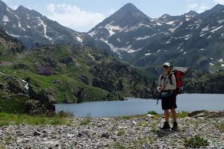
From Respomuso we crossed some TV-add-looking green prairies towards Llena Cantal Ibón.
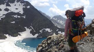
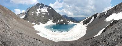
Once past the ibon, there was enough snow and ice for us to need our crampons. We put them on and started the climb to Tebarray or Piedrafita’s saddle (2771 m).
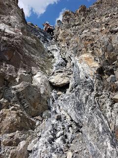
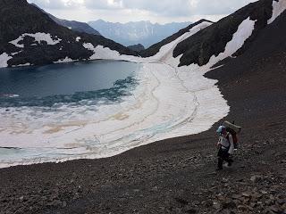
We moved forward on the snow slowly but steady until we reached the steepest and technical part of the pass. The gully we chose to cross was too steep for the snow to still be there at this time of the year.
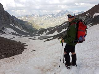
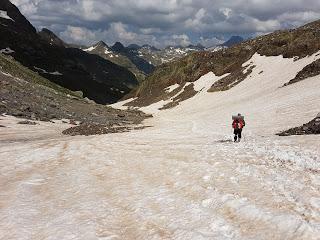
The challenge then was to take the crampons off. We manage to find a tight space to precariously take them off one of us at a time. After this transition, we scrambled up and over carefully but with no major problems. There’s a set of chains installed in a section of the pass but in our case they aren’t necessary because we found a different route that suited better our abilities and the conditions at that time. Maybe at some other time of the year they are crucial or they are really useful if you’re coming on the opposite direction.
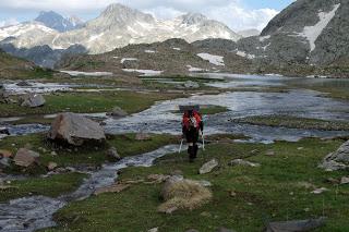
The gully takes you down to Tebarray Ibon, which was still thawing, then through Hell’s gate and into Piedrafita’s Gully which is way wider and particularly scenic one. This valley descends to Upper and Lower Bahimaña Ibones.
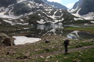
The descend through Piedrafita is long and the terrain is changing. At the top we put our crampons back on as there was still lots of snow while the lower part was a clean scree with rocks of different sizes.
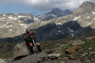
There wasn’t a clear pathway or an easier route. We tried to follow the milestones left on the way and guide our steps parallel to the river that flows into Lower Bachimaña Ibon.
We got to Bachimaña hut pretty tired after 11 hours of hiking and took advantage of the little shop in the hut to buy a couple of Aquarius (which will soon become our favourite drink) and Enrique’s favourite cookies called Principe (which literally translates for Prince and they are Marie cookies sandwiching a layer of chocolate cream). We had just enough time to set up the tent near the hut, wash up in the dam-ibon, prepare and eat diner and then crash in bed before it got dark. STAGE OVERVIEW:Date: 14th of July 2018Start time and altitude: 8:00 at 1288 mFinish time and altitude: 19:00 at 2175 mDistance: 22 kmCumulative elevation gain/loss: +1635 / -800Type of track: path, snow, screeWeather on the day: sunny, evening stormsAccommodation: free camping by Bachimaña guarded hut. Enrique & Marina
